
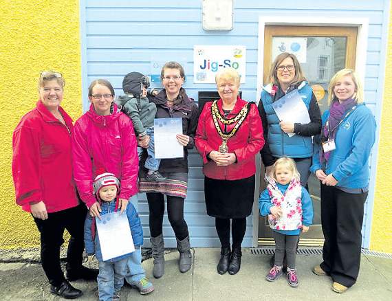
U3A

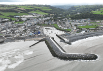
THE MONTHLY meeting took place on Thursday, 24 March. After a quick round-up of event reminders, the chairman, Pete Mears, introduced Chris Evans.Chris, a career geologist, leads the Cardigan U3A geology group.He told the group about the ways in which the Teifi Estuary had been chang-ing, based on LIDAR data.LIDAR, Laser Illuminated Detection And Ranging, is an airborne mapping technique that uses laser measurements to record air to ground distance – or, in favourable conditions, air to seabed distance.The Environment Agency, which provides the aircraft, has carried out a LIDAR survey across the Teifi estuary for Ceredigion County Council annually for the last 10 years.The aircraft is positioned and navigated using Global Positioning System (GPS) corrected to known ground reference points and the data collected is then used to measure land and inter-tidal topography and assess coastal erosion and geomorphology.Chris has been involved with the Teifi Mapping Project since its inception and he and his colleagues aim to continue monitoring a number of features in the estuary to improve our understanding of possible future changes.His presentation included a fascinating look into the future using best known predictions.This included extrapolating the highest tide yet recorded in the Teifi (3.4m) to see what might occur in 50 years and a century in the future.Surprisingly, both predictions gave the current Cardigan Hospital site a dry future, although some areas of Cardigan would need flood protection.The next meeting will be the AGM on Thursday, 28 April, from 2pm to 4pm at the Catholic Church Hall, North Road, when the astronomy group will give a presentation.New members are always welcome to attend the meetings. Alternatively, for more information on joining Cardigan U3A and its various groups, visit the website at www.cardiganu3a.org.uk
Comments
This article has no comments yet. Be the first to leave a comment.