
FORECASTERS have issued more warnings for heavy snow later this week.
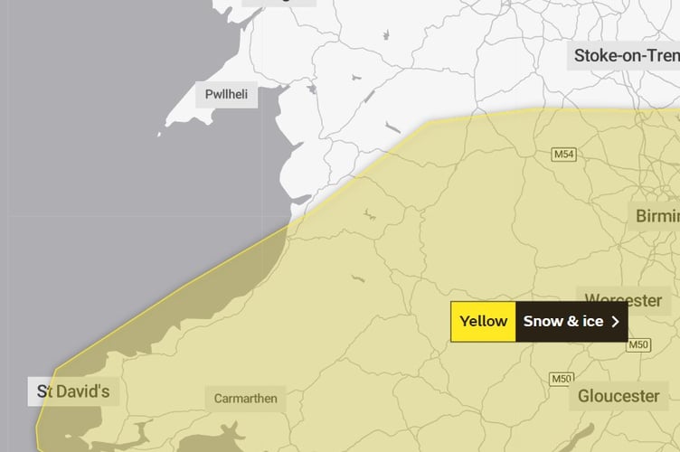
The Met Office has already issued a yellow warning for snow and ice this evening for a large swathe of mid and west Wales, but have this lunch time issued new warnings for Thursday and Friday, with the potential for heavy snow that could cause severe disruption.
There is also a warning in place for snow along south Wales on Wednesday.
Tonight


"A band of rain will edge southwards through the course of Monday evening and early Tuesday, this rain turning to snow on hills and perhaps to lower levels in places.
"Many areas will see little or no accumulations of snow, but 1 to 2 cm could settle in some spots, most likely over high ground and southern parts of the warning area. "The rain and snow is then expected to turn light and patchy as it slowly clears southern England on Tuesday. As skies clear overnight, ice is also likely to form readily on untreated surfaces."
Wednesday:
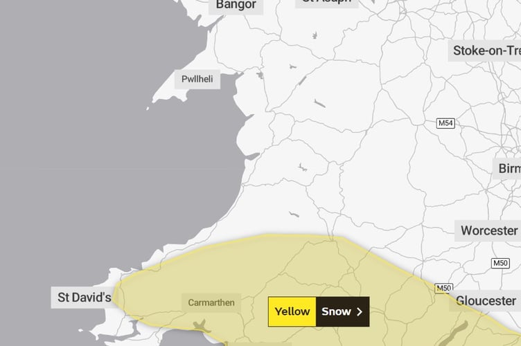
Spells of snow reaching parts of southwest England late on Tuesday evening will then spread north during the early hours of Wednesday before clearing away eastwards during Wednesday daytime. Many parts can expect accumulations of 1 to 2 cm of snow whilst over higher parts of southwest England, especially Bodmin Moor, Dartmoor and Exmoor, along with the hills and mountains of south Wales 5 to 10 cm of snow is likely for some. Untreated surfaces are also expected to become icy.
Thursday/Friday:
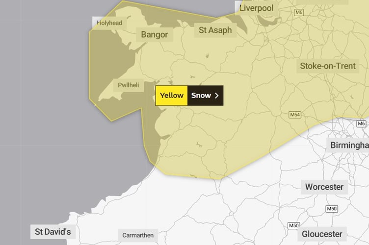
Snow could develop quite widely across the warning area on Thursday and Friday as a potentially quite deep area of low pressure moves across the UK.
The warning runs from 3am on Thursday until 6pm on Friday.
Parts of Northern Ireland, north Wales and northern England are currently expected to see the worst of the conditions on Thursday, with parts of Scotland and northern England then seeing the heaviest snow on Friday.
Event totals could bring 5 to 10 cm of snow to many locations, even at low elevations, with potentially 15 to 20 cm accumulating across the northern portion of the warning area.
Higher elevations of the North Pennines, Southern Uplands, higher parts of the Central Belt and the southern Highlands may see as much as 30 to 40 cm of snow in places. In addition, there is potential for strong winds, which may lead to blizzard conditions and drifting of lying snow.
Met Office Chief Meteorologist Dan Suri said: “Snow, ice and low temperatures are the main themes of this week’s forecast, as the UK comes under the influence of an arctic maritime airmass as cold air moves in from the north.
“Snow is already falling in parts of the north where some travel disruption likely, as well as a chance of some rural communities being cut off. Snow showers will continue through today and Tuesday here, and Northern Ireland will also be subject to some snow showers, especially over high ground.
“Ice will provide an additional hazard for many with overnight low temperatures well below 0°C for many. Further south wintry hazards will develop with parts of England and Wales affected by icy patches and snow in places tonight and likely further snow in parts of the south early Wednesday.”
Ice will be an additional hazard for many through the week, with sub-zero temperatures creating some hazardous travel conditions. Temperatures could drop as low as -15°C overnight on Tuesday in some sheltered Scottish Glens, especially where there’s fresh snow cover.
From late on Tuesday and early Wednesday, the snow risk is initially in the south as mild air gradually moves in from the southwest but brings with it snow as it meets the cold air. This risk of snow gradually spreads further north through the latter half of the week. Further warnings have been issued.
Met Office Deputy Chief Meteorologist Steven Keates said: “The impactful weather will continue through the second half of the week as mild air meets cold air with further snow, ice, wind and then rain likely later in the week and into the weekend.
“From Wednesday, the focus of further snow is across parts of southern England and south Wales, with snow likely to lower levels for a time, and many may wake up to a couple of centimetres of snow on Wednesday morning.
“Through Thursday and Friday the snow risk spreads to central and northern areas of the UK, though it’s not possible to pick out precise locations regarding who will see the heaviest snowfall. With a developing situation, it’s important to stay up to date with the latest forecast and further warnings are very likely.”
By Friday, winds will also be increasing as low pressure moves in from the west. It remains uncertain where the boundary between the mild air to the south and cold air to the north will lie exactly, but southern areas are more likely to see cloud, wind and rain, while areas to the north of that boundary could see further disruptive snowfall, with strong winds possibly creating snowdrifts in places.
Comments
This article has no comments yet. Be the first to leave a comment.