

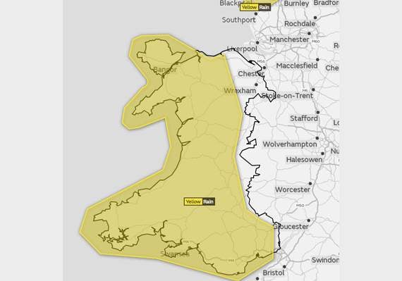
The Met Office has warned this weekend will be a washout and have issued a yellow weather warning for rain from Friday until Sunday.
Despite Wednesday’s weather pushing the mercury above 20°C, forecasters are expecting a persistent spell of rain across much of Wales from 6am on Friday until midnight on Sunday.
Meteorologists say a band of heavy rain, which has today been named Storm Callum by the Met Éireann, will be slow moving across all of west Wales from Friday, with the potential for over 200mm of rain in 48 hours.
The rain is expected to be accompanied by strong winds of up to 60mph, which when combined with high tides may lead to some coastal impacts due to large waves.




In addition, these winds may increase autumnal leaf fall, which would increase the potential for blocked drains and culverts, heightening the flooding risk.
As the rain moves north on Saturday, there is the potential for 50 to 80mm in 12 hours, and a chance of over 120mm in a few spots by the end of the event.
The rain is again expected to be accompanied by strong winds, which may increase autumnal leaf fall and potential for blocked drains/culverts, heightening the potential for flooding.
The Met Office warns that there is a small chance that homes and businesses could be flooded, and power cuts are possible.
If flooding does occur there is a chance that trains or bus services could be cancelled, and roads may be closed, which may shut off some communities.
Arriva Trains Wales has warned passengers to check their journey before departing, particularly up on the Cambrian Coast.
A spokesperson said: "The Cambrian line is also susceptible to flooding at Black Bridge in Glantwymyn when we see significant rainfall.
Comments
This article has no comments yet. Be the first to leave a comment.