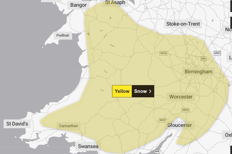
A yellow warning for snow has been issued for Wednesday night, with up to 15cm possible in places.
The warning runs from 4pm on Wednesday, 18 February, through until 6am on Thursday.
Forecasters say a period of snow could bring some disruption to parts of Wales and central England later Wednesday and overnight into Thursday.
The likelihood is very low according to the Met Office, but the weather front has the potential to cause some disruption.


The warning area avoids coastal areas along Cardigan Bay but covers Machynlleth and further east.
The warning says: "Whilst there is some uncertainty in the details, there is the potential for an area of rain and snow to affect parts of Wales and central England later on Wednesday and overnight into Thursday.
"2-5 cm of snow could accumulate quite widely above 150-200 metres, with perhaps as much as 10-15 cm above 250-300 metres in mid and southeast Wales, as well as Herefordshire and Shropshire. Some small accumulations of snow, typically less than 2 cm, are possible to lower elevations, especially from later Wednesday evening into the early hours of Thursday morning.
"Strong east to northeasterly winds will accompany the wet weather, which could exacerbate impacts in places."
There is a small chance of travel delays on roads with some stranded vehicles and passengers, a slight chance that some rural communities could become cut off and a small chance that power cuts will occur.
Comments
This article has no comments yet. Be the first to leave a comment.