
A warning has been issued for snow later this week as cold air returns over large parts of the UK.
The yellow warning for snow has been issued by the Met Office for between 3am on Thursday, 8 February, until 3am on Friday, 9 February.
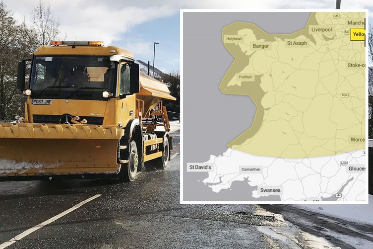
Forecasters warn that a period of snowfall could bring some disruption across north and mid Wales.
The warning says: "A band of rain, sleet, and increasingly snow, will push north on Thursday bringing up to 2cm snow at lower-levels, 2-5cm on ground above 200m, and perhaps as much as 10-20cm above 400m.


"The snow will ease later in the day, and may turn back to rain or drizzle, especially in the south and east of the area.
"There is some uncertainty with respect to the rain/snow boundary, and the northern limit of the snow, and so details may change in the coming days as confidence increases in these aspects."
The Met Office adds that there is a small chance of power cuts and that some rural communities may be cut off.
Met Office Deputy Chief Meteorologist Chris Almond said: “While the early part of this week will see some rain, at times heavy, gradually sinking southwards, there’s an increased signal for wintry hazards as we move through the week as cold air from the north moves over the UK.
“It’s from Thursday that the snow risk becomes more potentially impactful, as mild air attempts to move back in from the south, bumping into the cold air and increasing the chance of snow developing on the leading edge.
"While there are still lots of details to work out, the initial snow risk looks highest in northern England and Wales from Thursday. 1-2cm is possible to low levels, with 10-20cm possible over the highest ground within the warning area. This snow will likely gradually transition to sleet and rain later on from the south.”
The Met Office adds that it’s likely warnings will be issued and amended through the week, with an ongoing chance of ice warnings for some. Temperatures could drop as low as –10°C in rural parts of Scotland on Wednesday night, though it will be less cold further south.
Weekend weather
Although there’s still some uncertainty on the positioning of weather fronts from Thursday and the exact position of any snow, the trend further ahead is for the colder conditions with more-scattered wintry showers to spread south, reaching most parts of the UK over the weekend, though there will be plenty of sunshine between times – but this will lead to some frost by night.
Comments
This article has no comments yet. Be the first to leave a comment.