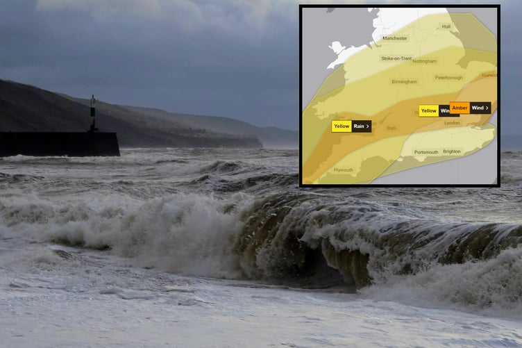
The first storm of 2024 will sweep across Wales today, bringing heavy rain and strong winds.
Storm Henk will bring a spell of very strong winds to parts of the UK leading to potential disruption to travel and infrastructure.
Initially the strongest gusts will be focused around southwest England and south Wales during the late morning and early afternoon, where an amber warning has been issued.
Here gusts of up to 80mph are possible in exposed coastal locations.
A Yellow warning for rain covers a wide area of England and Wales as further rain moves in through the day.
Rainfall totals from 5pm on Monday to 9pm Tuesday are likely to reach 15-30mm with 35-50mm in a few places.
Natural Resources Wales currently has 34 flood alerts in place and two flood warnings.
Met Office Chief Meteorologist Paul Gundersen, said: “Further wet and windy weather is forecast for the UK this week. Our latest analysis of the forecast shows an increase in the likelihood of very strong wind gusts across parts of southern Wales and England which is why we have issued this Amber warning this morning and named Storm Henk.
“Storm Henk will initially bring very strong winds to the southwest of England and Southern Wales, with gusts of up to 80mph possible. As Storm Henk moves north-eastwards across the south of the UK through Tuesday the strongest winds will also move eastwards, across the south Midlands, Home Counties and East Anglia through the afternoon and evening.”
The weather across the UK is forecast to remain unsettled through this week with westerly Atlantic conditions in charge. As we move through the weekend and into next week there are early signs of higher pressure developing which would settle the weather down and bring a spell of lower temperatures.


Comments
This article has no comments yet. Be the first to leave a comment.