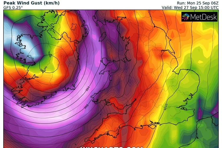
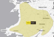
A weather warning for strong winds has been issued for later in the week - with gusts of around 80mph possible in exposed coastal areas.
Storm Agnes has been named by the Met Office as the deep area of low-pressure will impact much of the UK on Wednesday and into Thursday.
Storm Agnes will move into western areas of the UK and Ireland on Wednesday, with the strongest winds most likely on Irish Sea coasts, though it will be a widely windy day across the UK.
Met Office Chief Meteorologist Steve Ramsdale said: “While the precise track and depth of Storm Agnes is still being determined, there’s a high likelihood of wind gusts around 50 to 60mph for some inland areas. Exposed coastal areas could see gusts of 65-75 mph with a small chance of a few places seeing around 80mph.
“As well as some very strong winds for many, Storm Agnes will also bring some heavy rain, with the highest totals more likely in Scotland, northern England, Wales and Northern Ireland. Around 60mm of rain is possible in a few places over high ground in Scotland.”

A Yellow Warning for wind has been issued for a large area of the UK, with a rain warning also issued for parts of Scotland. Warnings will continue to be reviewed in the coming days as the exact track and strength of Storm Agnes becomes clearer.
The wind warning highlights the chance of some damage to building from strong winds, as well as the possibility of power cuts for some. Transport disruption is also likely, with some roads and bridges likely to close.
Storm Agnes is the first named storm of the storm naming season, which runs from September to August the following year.
The warning runs from midday on Wednesday until 7am on Thursday, with the Met Office saying the winds could be significantly disruptive.


Comments
This article has no comments yet. Be the first to leave a comment.