
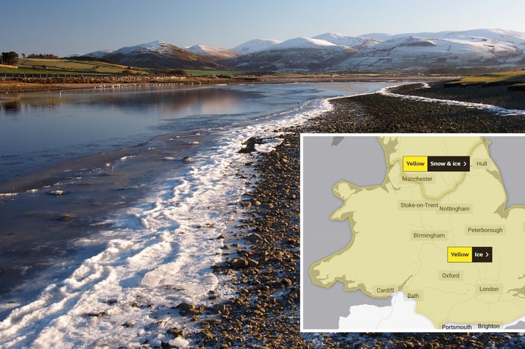
See this incredible footage of the frozen River Mawddach taken by Erfyl Lloyd Davies.
The dramatic footage shows how low temperatures have fallen.
More cold has been forecast for the weekend.
A fresh weather warning for snow and ice this weekend has been issued by the Met Office.


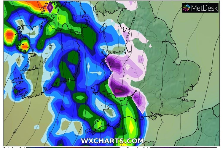
A fresh band of snow, sleet and rain is set to sweep across the UK on Sunday with temperatures expected to remain sub-zero into next week.
The yellow warning for ice and snow on Sunday has been updated by the Met Office this morning to include coastal areas of west Wales and to extend the time of the warning.
The Met Office explains in its warning, that runs from 3am on Sunday until 2pm: “A period of rain and snow mixed falling on frozen surfaces will lead to icy conditions causing some travel disruption.
“Widespread frozen surfaces ahead of a band of rain, sleet and snow, pushing northeast across the UK though Sunday, leads to a risk of icy conditions through the morning and early afternoon, before conditions turning much milder from the west.
“Any sleet or snow, at least to low levels, will likely only last an hour or two, before turning readily to rain, but this still onto frozen surfaces for a time.
“Temporary accumulations of 1-2cm to lower levels, and perhaps locally 3-5cm across the Welsh mountains, with any snow starting to melt readily from late morning.
“As this will melt rapidly, snowmelt may briefly add to the ice risk. In addition to the ice and snow risk, strong winds are expected, mainly over higher ground.”
The weather is expected to turn milder next week, with daytime temperatures in the low teens in Aberystwyth with the weather expected to turn wet and windy.
Comments
This article has no comments yet. Be the first to leave a comment.