

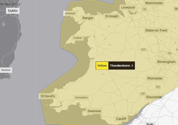
With temperatures set to hit the high 20s across much of Wales today, forecasters are warning that the sunny weather will be followed by thunderstorms later this week.
Temperatures in Aberystwyth are due to hit 27°C later today with Porthmadog expecting a high temperature of 28°C, but a yellow weather warning has been issued by the Met Office this morning for thunderstorms on Thursday.
The warning, which covers all of Wales from 11am until 8pm on Thursday, suggests heavy showers have the potential to bring travel disruption with some areas facing up to 40mm of rain in just two hours.
The Met Office says: “Following overnight rain and showers (on Wednesday), more intense showers and thunderstorms are expected to break out fairly widely from late morning, before easing during the evening.




“Whilst most areas will miss the most intense storms, torrential downpours are possible in a few places.
“Where these occur, there is potential for 20 to 30mm of rain in less than an hour and up to 40mm in two hours.
“This would have the potential to generate surface water flooding, especially if it falls over an urban area.”
The warning says there is a small chance that homes and businesses could be flooded quickly, with damage to some buildings from floodwater, lightning strikes, hail or strong winds; where flooding or lightning strikes occur, there is a chance of delays and some cancellations to train and bus services; spray and sudden flooding could lead to difficult driving conditions and some road closures; and there is also a small chance that some rural communities could temporarily become cut off by flooded roads.
Comments
This article has no comments yet. Be the first to leave a comment.