
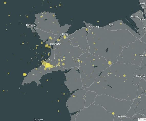
DWYFOR has been revealed as one of the UK’s earthquake hotspots.
A new map published on National Richter Scale Day last week (26 April) plots over 10,000 earthquakes that have happened in the UK since 1970.
The Llyn Peninsula has been named among the 10 most active areas, with almost 300 earthquakes recorded.
It is also the location of the biggest earthquake of the past 50 years, which was a 5.4 magnitude quake on 19 July 1984.

The map was created by Esri UK using British Geological Survey (BGS) data.
It celebrates the birth of Charles Richter, the US investor of the Richter Scale, who died in 1985.
Read the full story in Thursday’s north editions of the Cambrian News
Comments
This article has no comments yet. Be the first to leave a comment.