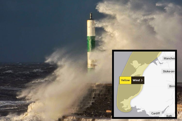
FORECASTERS have updated a weather warning for later today, with the worst winds limited to coastal areas of west Wales.
Winds of 60mph are possible along the west coast of Wales later today with a yellow warning in force from 3pm on Tuesday until 11pm.
The Met Office warns: “A developing area of low pressure moving north through the Irish Sea will bring a spell of strong winds accompanied by some heavy rain to western parts of Wales, northwest England and southwest Scotland during Tuesday afternoon and evening. “Gusts of 45-50 mph are possible inland and 60 mph around some Irish Sea coastal areas.”
Large waves are expected along seafronts, with high tide in Aberystwyth at around 12.20am tomorrow morning.


Short-term power cuts are also possible.
The warning area has been reduced in size to only include the coastal area.
A second warning has also been issued for Wednesday between 6am and 8pm, affecting south west Wales as far north as Aberystwyth.

The Met Office warns: “West or northwest winds are expected to increase during Wednesday morning, then remain strong for much of the day. Gusts of 40-50 mph are expected widely within the warning area, but some coastal areas, especially in parts of south and west Wales and Cornwall, could see gusts above 60-70 mph during Wednesday morning.
“Outbreaks of heavy rain or showers will accompany the strong winds.”
Met Office Chief Meteorologist, Matthew Lehnert, said: “A low pressure system will bring a period of wet and windy weather today and tomorrow. Thick cloud and heavy rain will continue to push in from west bringing 50 to 60 mph winds along western coasts. Snow is likely to fall over parts of upland Scotland overnight.
“Some disruption due to strong winds is likely on Wednesday, especially in southern and western areas, as well as the potential for heavy rainfall and even some snow, though the latter probably confined to high ground in the north. It will be another cool day with temperatures of 7 to 10 C in the west, with 11 to 13 C possible in the southeast, however it will feel colder in the strong winds.”
It will stay unsettled through the rest of the week, with sunshine and heavy showers for many on Thursday, and persistent rain in the south on Friday, before it becomes drier and brighter as we head through the weekend and more especially next week with temperatures starting to rise.
Comments
This article has no comments yet. Be the first to leave a comment.