

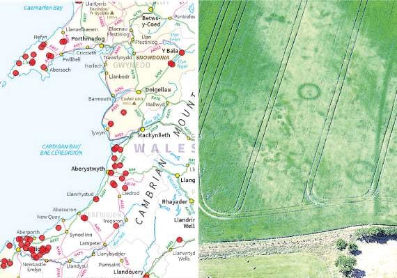
FOLLOWING the hot summer which revealed secrets of the land from above, archeologists have created an interactive map showing where Wales’ long-lost cropmarks appeared.
The remarkable outlines, captured from a plane by Dr Toby Driver from the Royal Commission on the Ancient and Historical Monuments of Wales - based in Aberystwyth - revealed settlements long forgetten in Wales’ countryside.
Dr Driver showed his findings to Sir Tony Robinson on Sunday in Channel 4’s Hidden Britain by Drone.
In the programme, the team visit a probable Roman site discovered on the Llyn Peninsula.
.png?width=209&height=140&crop=209:145,smart&quality=75)
.png?width=209&height=140&crop=209:145,smart&quality=75)
The unprecedented spell of hot, dry weather across Wales provided perfect conditions for archaeological aerial photography.
As the drought persisted across Wales, scores of long-buried archaeological sites were revealed once again as ‘cropmarks’, or patterns of growth in ripening crops and parched grasslands.
The Royal Commission’s aerial investigator, Dr Toby Driver, took to the skies across west Wales documenting known sites in the dry conditions, but also discovering hitherto lost monuments.
These discoveries have been collated and all the information has been entered into an interactive map on the Royal Commission on the Ancient and Historical Momuments of Wales’ website.
See this week’s north editions for the full story, in shops and online on Thursday
Comments
This article has no comments yet. Be the first to leave a comment.