

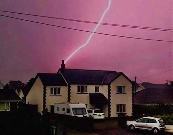
FORECASTERS have issued a yellow warning for thunderstorms across all of Wales for the next six days.
Following flash floods on Monday that closed a number of shops and restaurants in Aberystwyth and brought parts of Ceredigion to a standstill, the Met Office has today extended its warning for thundery weather up until next Monday.
Temperatures are expected to cool down by Friday, but there is still a warning of continuing thunderstorms that could hit anywhere.
The Met Office predicts storms across Wales and says "the risk of severe thunderstorms will continue in places throughout the next six days".
.png?width=209&height=140&crop=209:145,smart&quality=75)
.png?width=209&height=140&crop=209:145,smart&quality=75)


A spokesperson for the Met Office says on Wednesday (today): “Whilst many parts will see a good deal of dry weather, areas of thunderstorms are likely to continue to develop over parts of the UK, particularly later in the afternoon.
“Many places will stay dry.
“However, where the storms occur they will be intense. Rainfall totals of 30-40 mm may fall in less than an hour, with a small chance of 60 mm falling in an hour and 70-100 mm falling in 2-3 hours.
“Large hail, frequent lightning and gusty winds will be additional hazards. Most thunderstorms will die out during the evening though a few may continue in to the night.”
On Thursday, areas of thunderstorms are expected to develop over parts of England and Wales. Some intense thunderstorms may occur, in some instances associated with torrential rain, large hail and frequent lightning, as well as strong gusty winds. Rainfall totals of 20-30 mm could fall in an hour, with some locations potentially receiving 40-60 mm in 3 hours, although these will be fairly isolated.
Friday and Saturday: Areas of showers and thunderstorms associated with a hot and humid air mass stranded across the southern half of the UK are expected to continue through Friday, and not solely during daylight hours.
Many areas encompassed by this warning will miss the thunderstorms altogether, but where they occur, heavy rain (20-30mm in an hour, and possibly as much as 50mm in 2 to 3 hours), frequent lightning, and in some places large hail are all potential hazards. The greatest chance of impactful showers is expected to be in the southern half of this warning area, where afternoon showers are more likely to be slow moving and prolonged.
Sunday and Monday: Areas of heavy showers and thunderstorms are expected to develop on Sunday, with some persisting into the late evening.
A similar day on Monday, though the thunderstorms more likely to clear earlier in the evening. Many areas within the warning area will miss the thunderstorms altogether, but where they occur , the heavy rain (15-25mm) is expected in an hour, and as much as 40mm in 2 or 3 hours. Thunderstorms are likely to be accompanied by hail , lightning and gusty winds.
Comments
This article has no comments yet. Be the first to leave a comment.