

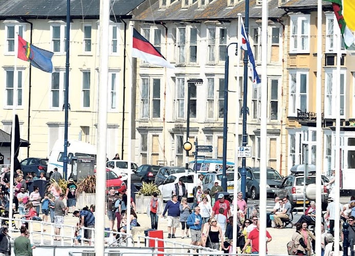
NEW signs have been placed around three Ceredigion towns reminding people of the alcohol free zones – and that those who break it face a £500 fine.
Ceredigion County Council says it has installed new signs in Aberystwyth, Cardigan and Lampeter to ‘help play a positive part in improving experiences of residents and visitors alike.
Public Space Protection Orders “Alcohol Free Zones” were originally placed in Aberystwyth, Cardigan and Lampeter town centres in 2017 and have since been extended to October 2023.
Following renewal of the orders, a survey was conducted by Ceredigion Community Safety officers of the signage whereby 33 missing and unreadable signs were replaced to remind people of these alcohol-free zones.


Cllr Matthew Vaux, Ceredigion County Council’s Cabinet Member for Public Protection, said: “It is hoped that these protective measures, in conjunction with the support of the local police, will continue to play a positive part in improving the experience of residents and visitors in Aberystwyth, Lampeter and Cardigan Town Centres.”
Public Space Protection Orders are made under the Anti-social behaviour, Crime and Policing Act 2014 and prohibit the consumption of alcohol in public places within the designated zones. They allow Police Officers to confiscate any alcohol being consumed or any alcohol they believe is about to be opened and consumed within the Zones.
An offence is committed by a person if they refuse to surrender the alcohol to the Police Officer or if they refuse to move out of the Zones to consume the alcohol, and they may be taken to court with the maximum fine for this offence being £500.
Areas in Aberystwyth which are covered by the order and are a "public place"
• From the police station in Park Avenue going into town including all public areas to the north which include the Vale of Rheidol Railway car park, livestock market, Matalan Ltd car park and Matalan Stores including all other car parks and stores in Ystwyth Retail Park, Tesco Superstore car park, Tesco Superstore and Marks and Spencer Store, public toilets and the public areas around the Hen Ysgol Gymraeg.
• All public areas along Mill Street, Powell Street, Grays Inn Road and all public areas between Grays Inn Road, Queens Street and Powell Street, William Street, George Street and into Bridge Street, into South Road and including all public areas behind South Road. All public areas from the rear of South Road south along into the harbour down towards the bar and around to the jetty.
• All public areas leading off South Road into and including High Street, Prospect Street, Castle Street, Rheidol Terrace, Rheidol Place, Quay Road, Custom House Street and Penmaesglas Road.
• From the jetty going north along South Marine Terrace towards the New Promenade including the beach and breakwaters to the west and the area known as South Marine Terrace. North along the New Promenade including the beach to the west, junction with South Road and all public areas from South Road into Sea View Place, Vulcan Street including the castle grounds, children’s play areas and the area around St Michaels Church.
• Continuing along the New Promenade to the Old University and the public area in front of the Old University which includes the crazy golf course, public areas behind the Old University including King Street towards Laura Place, St Michaels Place, St James’s Square and Princess Street.
• Public areas from Laura Place to Sea View Place, High Street, Upper Great Darkgate Street and into Castle Street, including public areas around the Market Hall.
• From The Promenade at the junction with Pier Street, including Pier Street and New Street across to Laura Place. Public areas from Pier Street down into Eastgate, Eastgate down to Upper Portland Street including the public areas with the junction with Market Street, junction with Baker Street into Great Darkgate Street, Alfred Place, Crynfryn Buildings, Corporation Street and into Terrace Road.
• All public areas along Marine Terrace including the beach and jetty to the west, junction of Marine Terrace with Terrace Road, entire length of Terrace Road across to Alexandra Road.
• Marine Terrace north into Victoria Terrace including Albert Place, around to the rear of Alexandra Hall and south into Queens Road.
• From Queens Road including all public areas up Queens Avenue including North Road and down into Northgate Street.
• All public areas along Queens Road which include the bowls club and tennis courts at the rear of Queens Road, Lovedon Road and Vaynor Street down into Queens Road.
• Junction of Queens Road with Bath Street into Bath Street. Queens Road including all public areas from Queens Road into Portland Street, Portland Road into Terrace Road.
• Queens Road Junction with North Parade across into Thespian Street including junction of Thespian Street with Cambrian Street into Terrace Road, Brewer Street into Alexandra Road.
• Great Darkgate Street down into North Parade. Chalybeate Street into Mill Street roundabout including Cambrian Place and Union Street leading into Alexandra Road.
• All public places in Alexandra Road including the Rheidol Retail Park and the Railway Station.
• Elm Tree Avenue and Plascrug Avenue leading down to Plascrug.
• Junction of Thespian Street into Stanley Terrace and leading into Stanley Road, Poplar Row, Skinner Street and Trinity Place.
• Northgate Street and all public places including the junction with Pound Place leading on to Trinity Road and all public places in the Buarth including Edgehill Road, Buarth Road, Coed y Buarth, Banadl Road and then down into Llanbadarn Road.
• Junction with Llanbadarn Road and Penglais Hill and all public places to the south of Penglais Hill which include Penglais Terrace, Maes Gogerddan going out of Aberystwyth including Bronglais Hospital car park.
• Past Bronglais Hospital and including the area around and to the rear of the hospital bordering with the road to the National Library of Wales and then down Caradog Road including public areas around Bronglais Hospital.
• From Caradog Road including all public areas between Caradog Road and Penglais Hill to the junction of Caradog Road with Llanbadarn Road.
• Along Llanbadarn Road including all public areas between Llanbadarn Road and Boulevard St Brieuc. Along Llanbadarn Road and into Plas Avenue to include public areas adjacent to the Plascrug Leisure Centre, along Plascrug Avenue including public places around Ysgol Gymraeg and Ysgol Plascrug.
• Across to Boulevard St Brieuc which includes the park and ride car parks and back to Aberystwyth police Station.
Areas in Lampeter which are covered by the Order and are a "public place"

• College Street (A482) from Harford Square to junction with North Road and Bryn Road
• Harford Square
• Bridge Street (A492) from Harford Square to No. 48 adjacent to lane adjoining New Street
• Bryn Road from junction with Church road to roundabout adjoining North Road and College Road
• Church Street up to St. Peter’s Church
• High Street (A475) from Harford Square to junction with Temple Terrace and Church Street
• Market Street
• Cambrian Road/car parks adjoining Bryn Road
• Parc Yr Orsedd War Memorial and amenity area on corner of Bryn Road and North Road
• Supermarket car park off Market Street and Bryn Road
• Temple Terrace Park (now known as Parc St Germain-Sur-Moine)
• Part of Temple Terrace (up to junction with Peterwell Terrace)
• St. Thomas Street (including land adjacent to electricity sub-station)
• The Common car park and paved seating area (adjacent to Victoria Terrace)
• St. Peter’s Church grounds
Areas in Cardigan which are covered by the Order and are a "public place"

• Pont-Y-Cleifion up to roundabout (including Telephone Exchange and Ambulance Station)
• Finch’s Square up to junction with Williams Terrace
• Cardigan & District Hospital and buildings
• Prince Charles Quay from Priory Bridge to Cambrian Quay
• Cambrian Quay up to slipway at Netpool
• Netpool Road
• Netpool
• Netpool recreation Ground, skate park, changing rooms, cemetery shelters and car parks up to Greenfield Row
• Maes Radley playing field
• Greenfield Row
• Greenfield Square
• Bath-House Road up to Fire Station
• Feidrfair including public conveniences
• North Road
• Aberystwyth Road from point adjoining North Road up to junction with Greenland Meadows
• Pendre
• Cardigan County Secondary School, fields and dingle area up to Swyn- yNant and to point adjoining North Road
• Coleg Ceredigion
• Leisure Centre
• Victoria Gardens including band Stand and Toilet area, and War Memorial .
• King George’s Field including football ground, rugby ground, tennis courts,
bowling green, playground and shelter
• Gwbert Road from Victoria Gardens to point of access to school grounds between Bronant and Pant yr Haul
• Park Avenue
• Greenland Meadows from junction with Park Avenue to junction with Aberystwyth Road
• Napier Gardens up to Maes-yr Haf
• Maes-yr Haf from junction with Napier Gardens and North Road
• Napier Street
• High Street
• Williams Terrace
• William Street
• Williams Row.
• Priory Street
• Priory Court
• Pwllhai
• College Row
• Guildhall Square
• Queen’s Terrace
• Quay Street
• Eben’s Lane
• Lower Mwldan
• Middle Mwldan
• Upper Mwldan
• Carrier’s Lane
• Rook Terrace
• Bridge Street from junction with The Strand and Cardigan Bridge
• Grosvenor Hill
• The Strand
• Morgan Street
• St. Mary Street
• Chancery Lane
• Market Lane, Albion Terrace
• High Street Arcade
• Church Street
• Riverside car park
• Fairfield and swimming pool car park
• Cardigan County Primary Infants School, public areas/buildings
• Theatre Mwldan Car Park and toilets
• Gloster (Gloucester Row Car Park)
• St Mary’s Church and churchyard
• Area to rear of St Mary’s Church
• Old St Mary’s School grounds, (off Pont-y-Cleifion)
• Area near Council depot and Ambulance Station, (off Pont-y-Cleifion)
• Rear/side access of swimming pool
Comments
This article has no comments yet. Be the first to leave a comment.