
The UK is entering a more unsettled period of weather, with thunderstorms dominating the forecast up to Wednesday.
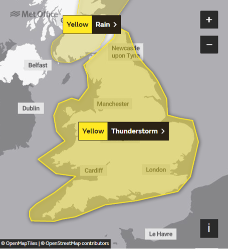
A number of Yellow thunderstorm warnings have been issued for the UK, highlighting the potential for frequent lightning, large hail and flash flooding impacts from the intense rainfall which could see values of at least 50mm in a two or three-hour period in a few places.
Dan Suri is a Met Office chief forecaster. He said: “The change in weather regime will see the heat of the last few days slip away from the south and east, this will be increasingly replaced with more unsettled conditions with heavy showers, thunderstorms and torrential downpours being key hazards over the UK until Wednesday.
“Although not all places will be affected, where thunderstorms occur there is the potential to for very large rainfall totals, but when that heavy rain is falling on extremely dry ground, the risk of flash flooding is much more pronounced.


“With no meaningful rainfall in some southern locations since June, soils in these areas have become baked by the sun turning them into hard almost impenetrable surfaces. Any rainfall in these areas won’t be able to soak away and instead it will wash off soils and other hard surfaces, creating flash flooding in some areas. This excess water can rapidly inundate some flood-prone areas. Particular areas of cautions are low-lying stretches of road and those areas adjoining sloping fields where water can quickly run off, creating fast-emerging hazards.”
By Wednesday the focus will shift away from Wales with warnings across southern England.
Deputy chief Daniel Rudman said: “Although the warnings are at a broad scale, forecasters expect individual thunderstorms to be quite isolated, and many within the warning in not encountering storm or heavy rain.
“After Wednesday conditions will settle down somewhat for most. Whilst there may be some periods of rain, and it will be unsettled at times in northern and western parts, the heavy downpours associated with thunderstorms become less likely.”
Although the first rainfall in several months will fall across parts of southern England, the summer rainfall in parts of southern and central England is so far less than a quarter of what would be expected in a typical summer. With two weeks to go until the end of summer, it is not feasible that any expected rainfall will balance the books to produce average results. For some areas Summer 2022 will be remembered as a notably dry year.
Comments
This article has no comments yet. Be the first to leave a comment.