

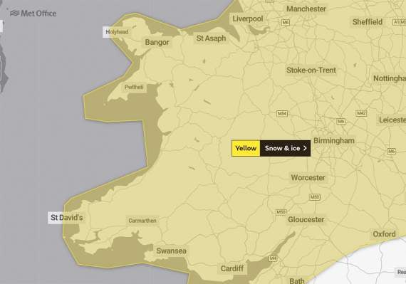
A weather warning that comes into effect this evening has been upgraded by forecasters.
A yellow warning was issued by the Met Office yesterday for ice across much of Wales, but this has been upgraded this morning to include a warning for snow.
The warning, which comes into force at 5pm today (Thursday) and is in place for all of Friday, says: "Showers, a mixture of rain sleet and snow, are expected to fall onto frozen surfaces leading to icy stretches forming.
"In addition, a more persistent spell of rain and hill snow is likely to move south across northern England and North Wales during Thursday evening and night.




"This then gradually moving into parts of central and southwest England and southeast Wales on Friday.
"Whilst ice is expected to be the most widespread hazard, snow is likely in places too.
"Snow is most likely to fall over The Pennines, North York Moors and the high ground of Wales and southwest England, with 2-5 cm possible here.
"Elsewhere, whilst some snowfall is possible, accumulations are likely to be slight and temporary.
“Freezing fog patches are also likely to persist and may prove an additional hazard with areas of visibility less than 100 metres at times."
Comments
This article has no comments yet. Be the first to leave a comment.