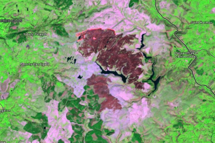
Satellite images have revealed the scope of the damage from Elan Valley’s wildfire.
The weeklong blaze was visible from space, showing 8,000 hectares burned, the equivalent of over 11,000 football pitches.
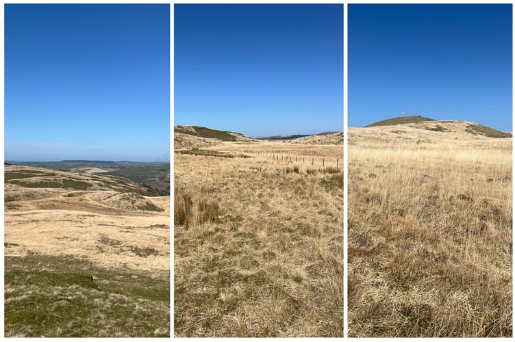
Experts stated the wildfire last week which blazed from 25 April-1 May was on a “scale not seen before”, after wildfires also impacted the 70 square mile estate last year.
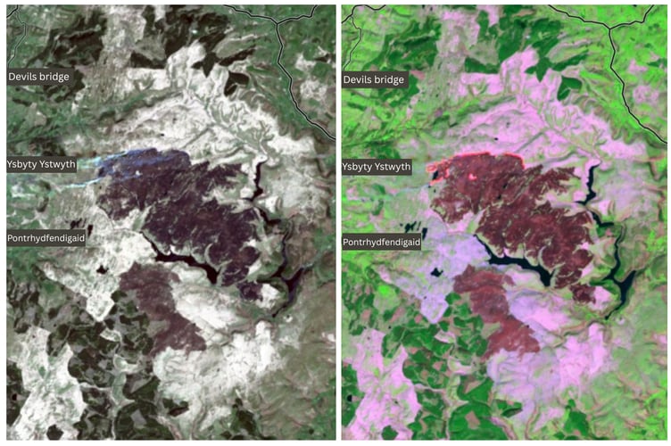
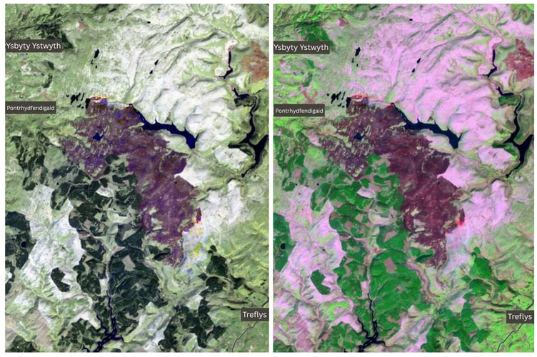
The satellite images, enhanced using the SWIR band of the electromagnetic spectrum, show the contrast of black burnt areas, the orange line of the active fire (captured on 29 April) and the bright pink showing the molinia grass that many blame for the extent of the fire.


.png?width=209&height=140&crop=209:145,smart&quality=75)
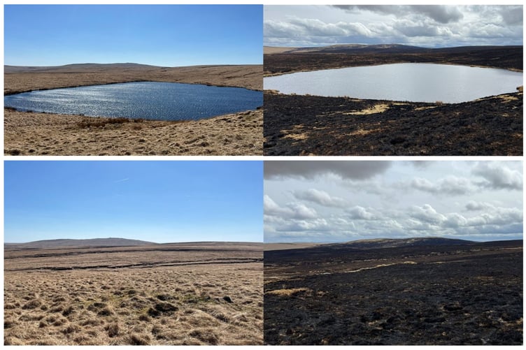
Uplands ecologist Ben Clarke from Aberystwyth University said: “Wildfires on this scale are unprecedented; we have nothing to compare it to.
“Seeing it in person, the whole landscape is black, it’s otherworldly, visceral.
“It’s a bit scary, we don’t have much information about why it's happening - that’s what we’re working on now.”
Wildfires are a new phenomenon for Wales, with little data before the wildfire sprees of 2025, 2026, and 2018; however, wildfires are projected to get worse, as Ben explains: “Mid Wales didn’t use to have a problem with wildfires, but climate change is now enabling this wildfire period every March and April.”
UK-wide, wildfires have typically occurred every 50-100 years, but they are now projected to increase to four times a year by the 2080s.
2025 was an incredibly bad year for wildfires, with Ben’s mapping finding that 20,000 hectares of Wales burned.
One of the main problems is the increasing dominance of molinia caerulea or ‘purple moor grass’.
During spring, the native plant is dead and incredibly flammable.
With an “unsustainable” increase in dominance over the last 50 years, the grass recovers quickly after a fire, becoming more prevalent the more wildfires occur.
One area of research is how to reduce this “fuel-load”, with little nutritional value to livestock, many animals won’t graze it.
Solutions including active cutting are being explored, however it often grows in hard-to-reach areas like blanket bog - another problem in itself.
Below the bogs is peat, an excellent carbon store holding thousands of years of carbon, which can burn for months if it catches fire.
Peatland has been drained in the UK over the years, with governments and environmental NGOs only recently beginning peatland restoration to raise the water table, rewet the land and hopefully deter wildfires from starting.
Fire services rarely know how wildfires start, with Mid and West Wales Fire and Rescue Services admitting they did not know the cause of last week's fire.
The Elan Valley Trust joined the fire services to call for the public's help in protecting nature: “Wildfires don't just threaten human life and livelihoods; they destroy rare flora, insects and fragile ecosystems, and the nesting grounds of our local bird populations.
“Sticking to the Elan Valley countryside code helps prevent this kind of catastrophic event - no fires/barbeques, no overnight camping, no littering and no illegal off-roading.”
Comments
This article has no comments yet. Be the first to leave a comment.