
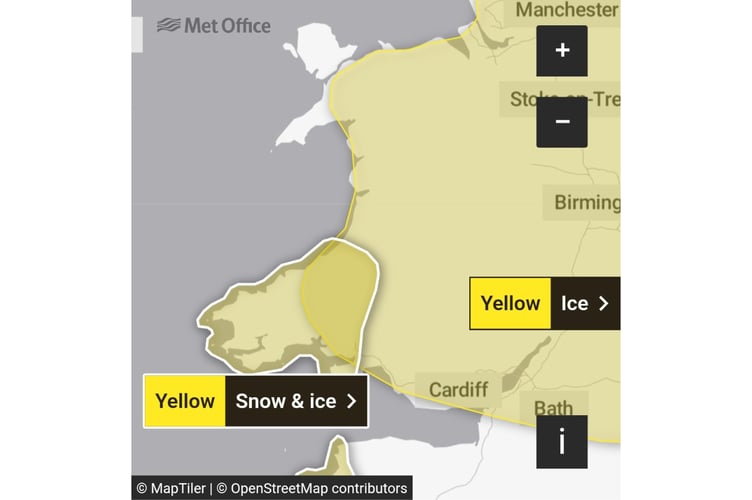
Yellow weather warnings for ice covering large areas of Gwynedd and Ceredigion, and snow for areas including Lampeter, have been issued.
The ice warning is in place from Wednesday midnight until 11am.
“Rain and hill snow, followed by clearing skies, will lead to the risk of icy patches on Tuesday night into Wednesday morning,” the Met Office said.
“Outbreaks of rain will spread southwards on Tuesday night into Wednesday morning, potentially falling as snow on hills for a time, before clearing to the south. As skies clear later, allowing temperatures to fall close to or below freezing, this will bring the risk of icy patches on untreated surfaces. Some temporary slushy snow deposits will be possible where snow persists for long enough, especially on grassy surfaces, but any significant accumulations will be largely restricted to communities and transport routes above about 300 m elevation.


“Wintry showers will feed southwards across southwest Wales and parts of Devon and Cornwall through Wednesday and Thursday, moving well inland on brisk northerly winds. Some snow accumulations will be possible in places, especially overnight and/or farther inland away from the immediate windward coast. Whilst some places will see little or no lying snow, where showers are most frequent accumulations of 2-5 cm are possible, and perhaps up to 10 cm in a few isolated spots, more especially on hills above 200 m elevation in Pembrokeshire and west Carmarthenshire.
“Gusty winds and hail may accompany some of the showers, and where showers persist and/or snow partially thaws and refreezes overnight, this will bring a risk of ice.”
The snow and ice warning is in place from Wednesday midday to Thursday at 11.59pm.
Comments
This article has no comments yet. Be the first to leave a comment.