
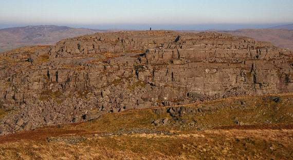
TWO hill mappers have discovered a new Meirionnydd mountain.
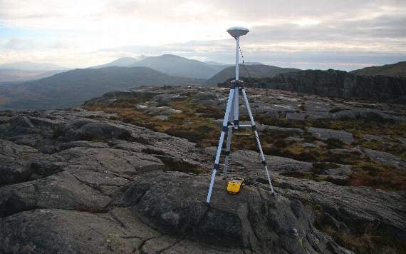
The new classification was made after two friends, Myrddyn Phillips and Aled Williams, accurately surveyed it using sophisticated GPS technology to find that it is more prominent than once thought.
The newly-crowned mountain is named Foel Penolau and it is situated in the north part of the mountain group commonly referred to as the Rhinogydd in the Snowdonia National Park.
These mountains offer the hill walker some of the roughest mountain terrain in Wales.
-with-her-son-Rufus-her-partner-and-younger-son-Noah.jpeg?width=209&height=140&crop=209:145,smart&quality=75)


Mountain classification is stringent requiring a minimum height of 2,000ft (609.6m) and at least 98.4ft (30m) of drop from summit to col (the lowest point of a ridge or saddle between two peaks).
Foel Penolau easily meets the first criterion at an elevation of 2,016ft (614.4m), but it was previously considered to have only 85ft (26m) of drop thereby falling short of mountain status.
The survey confirmed that Foel Penolau has a drop of 104.7ft (31.9m) and as a result it has been added to the list of Hewitts – Hills in England, Wales or Ireland over 2,000 feet high which have a minimum drop of 30m.
The promotion of Foel Penolau means that Wales now has 136 Hewitts and it is the first time that a Welsh hill has entered this classification due to its drop increasing to over 98.4ft (30m) since the list was first published in 1992.
The survey of Foel Penolau was conducted over two days.
Mr Williams said: “The col of Foel Penolau is situated on a large boulder field, which makes it a difficult place to survey. Some of the boulders are over 7ft high and finding the lowest point between Foel Penolau and its neighbouring higher hill was like fining a needle in a haystack. After a lot of work we were satisfied with our efforts and proceeded to visit the summit to gather further data from its two tops.”
To complicate matters Foel Penolau has two tops with each given a 2,014ft (614m) map height.
See this week’s north editions for the full story, in shops and online now
Comments
This article has no comments yet. Be the first to leave a comment.