
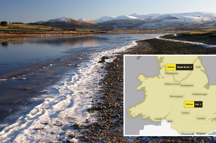
FORECASTERS have issued two warnings for icy conditions over the weekend and are unable to say with any certainty whether we will see a white Christmas this year.
A fresh warning for ice has also been issued this evening (Friday) which runs from 9pm until 10.30am on Saturday.
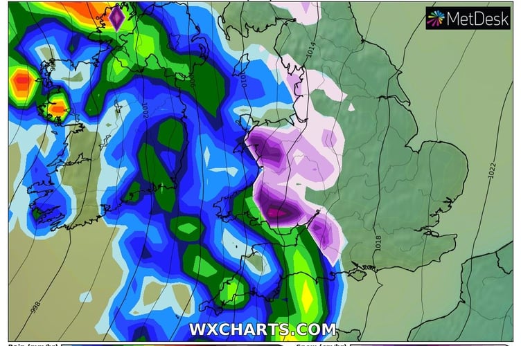
The Met Office says: "Bands of showery rain are expected run inland tonight, turning to sleet and snow over some of the higher ground.
"Surfaces are very cold at present, posing the possibility of ice in some areas, the likelihood of this perhaps increased in places by "wash-off" of road grit or salt.

"Above 200 to 300 metres elevation some snowfall is likely, with a few cm over some trans-Pennine routes."
The yellow warning for ice and snow on Sunday has been updated by the Met Office this morning to include coastal areas of west Wales and to extend the time of the warning.
The Met Office explains in its warning, that runs from 3am on Sunday until 2pm: “A period of rain and snow mixed falling on frozen surfaces will lead to icy conditions causing some travel disruption.
“Widespread frozen surfaces ahead of a band of rain, sleet and snow, pushing northeast across the UK though Sunday, leads to a risk of icy conditions through the morning and early afternoon, before conditions turning much milder from the west.
“Any sleet or snow, at least to low levels, will likely only last an hour or two, before turning readily to rain, but this still onto frozen surfaces for a time.
“Temporary accumulations of 1-2cm to lower levels, and perhaps locally 3-5cm across the Welsh mountains, with any snow starting to melt readily from late morning.
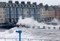
“As this will melt rapidly, snowmelt may briefly add to the ice risk. In addition to the ice and snow risk, strong winds are expected, mainly over higher ground.”
The weather is expected to turn milder next week, with daytime temperatures in the low teens in Aberystwyth with the weather expected to turn wet and windy.
Met Office Deputy Chief Forecaster, Helen Caughey, said: “The northerly airflow and cold conditions which have dominated our weather patterns over the last 10 days will start to lose ground to a push of mild air from the southwest on Sunday.
“As the mild air meets the cold air currently in situ over the UK there will be a transient spell of snow, potentially to low levels, especially in the north. Add to this the risk of rain falling onto frozen surfaces, and strong winds over upland areas of northern Britain, bringing blizzard conditions, and this could be a day to avoid travelling in some areas, although the snow should turn to rain later.”
“There is also a brief risk of a period of freezing rain, most likely to impact areas from the Pennines northwards, which could result in some power interruptions.
“It will remain unsettled next week. Strong winds could prove disruptive at times especially through the first half of the week and there is the possibility of some persistent rain for parts of the southwest. Although not as cold as we are currently experiencing, we could potentially see a return of some wintery hazards at times, mainly across higher ground in the north, but there is still a lot of uncertainty in how prolonged this might be and what associated hazards it might bring.
“The unsettled picture for next week means, that although Christmas is just a week away, it is still not possible to say with any certainty if we will have a white Christmas Day or not.”
Comments
This article has no comments yet. Be the first to leave a comment.