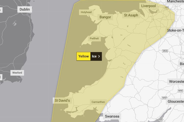
A YELLOW warning for ice has been issued overnight across west Wales, but the weather is set to turn milder and wilder.
An ice warning is in place across western parts of Wales from 6pm this evening until 10am on Friday.
The warning states: "Wintry showers will fade this evening and overnight, but where surfaces are damp or snow-covered as a result of these showers some icy patches may form as skies clear and temperatures drop."
It looks set to be warmer than Wednesday night, with overnight temperatures of -1°C in Aberystwyth.


The Met Office says the cold Arctic air currently in place over the UK will start to be displaced from the north and west from Friday, allowing weather conditions to take on an Atlantic influence again with milder air eventually returning.
However, while temperatures will increase from the markedly low figures of recent days, this change in airmass will also introduce a return to much windier weather for Sunday and Monday as well as bring spells of rain, especially in the west.
Met Office Deputy Chief Meteorologist David Hayter explained: “Conditions will stay cold on Friday but a change in weather type is on the way, bringing milder air for the UK during the course of the weekend.
“This change will initially be relatively benign in terms of weather impacts, with a dry Friday and start to Saturday for many in the south of the UK. The Atlantic influence will then introduce some wet and windy weather, with a deep area of low pressure approaching from the west on Sunday.
“While detail is still being worked out, we expect windy weather for many and some heavy rain in the west."
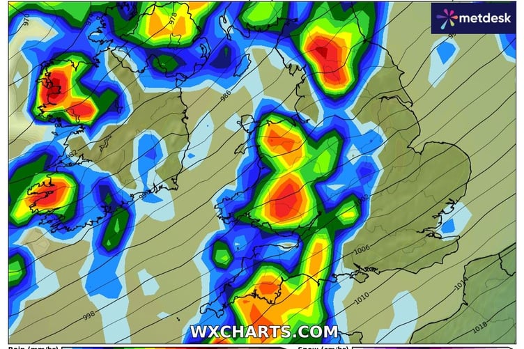
A yellow warning for rain is in place from 6am on Sunday until 6am on Monday, with forecasters saying: "Spells of heavy rain, combined with strong winds at times, will move across Wales over the weekend and into early Monday.
"The heaviest rain is expected over hills during Sunday with 20-50 mm falling widely and the potential for peaks of 80-100 mm, most likely over Eryri.
"Milder conditions will also result in the thaw of lying snow."

This warning is coupled with another yellow warning for wind, which states: "Strong winds are expected to develop widely across the UK on Sunday, persisting into early Monday across parts of England and Wales.
"Within the warning area, many places are likely to see southwesterly winds gust to around 50-60 mph and gusts may reach 60-70 mph for exposed locations (e.g. coasts). There remains a chance of stronger winds impacting parts of this area for a time but this aspect remains uncertain with further updates to the warning to be expected over the coming days."
Comments
This article has no comments yet. Be the first to leave a comment.