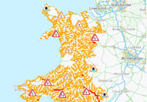
FORECASTERS have been having their say on whether Wales will have a white Christmas this year.
Christmas Day weather in recent years has been relatively mild, but one forecast model is showing snowfall in the run up to the festive period this year across west and north Wales.
WXCharts, which is powered by Metdesk, shows snowfall over the weekend before Christmas Day, which may still lay on the ground when Santa Claus makes his trip to Wales.
The model shows snow arriving from the west on Thursday, 21 December, with a second flurry across much of central and south Wales on Saturday, 23 December, leaving around 2cm of snow on the ground and up to 8cm at higher levels.
The modelling shows that this snow will remain on the ground come Christmas Day, away from coastal areas.
The Met Office is less sure however.
It says the jet stream is set to move north this week, allowing high pressure to build, bringing milder weather.
The jet stream may move south again later next wee, bringing more unsettled weather and wintry showers.
Met Office Chief Forecaster, Paul Gundersen, said: “The high pressure will draw up warmer air from the southwest and as we go into the coming weekend, we will see milder conditions by both day and by night for all.
“It looks like this pattern will last into the first half of next week meaning the mild conditions will continue with some outbreaks of rain likely at times, mostly across the north and the northwest.
“Later next week and the days running up to Christmas there are some suggestions that the jet stream will drift further south, allowing conditions to turn more widely unsettled.
“There is also a chance of winds switching to more of a northwesterly direction, allowing conditions to become a little colder, with a risk of some wintry showers developing in the north.
“At this stage there is very little sign of any widespread or severe cold and wintry weather.”


Comments
This article has no comments yet. Be the first to leave a comment.