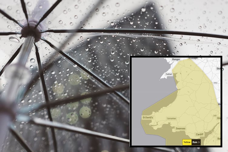
A YELLOW warning for rain - with the possibility of some snow - has been issued for Friday by the Met Office.
The yellow warning runs from midnight until 3pm on Friday, with heavy rain expected to cause some disruption.
The warning says: "A band of rain, heavy at times, is expected to move north and east on Friday. 10 to 15 mm of rainfall is likely widely, with perhaps 30 mm in a few locations.
"With much of the rain falling in three hours some travel disruption is probable.


.png?width=209&height=140&crop=209:145,smart&quality=75)
"Some snow is also likely to affect some higher routes and communities for a brief time."
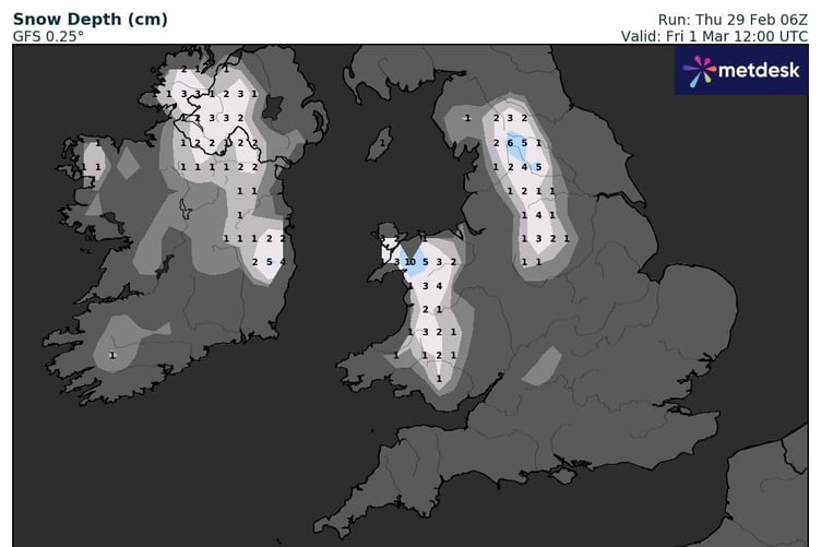
One weather forecast model is predicting snowfall across much of Wales, with snow sticking for a while on higher ground.
Forecast from the Met Office
Today:
A cloudy day with perhaps some showery rain at times, mainly in the south. Brighter skies and scattered blustery showers may approach western areas later. Light winds but feeling chilly. Maximum temperature 9 °C.
Tonight:
Generally dry this evening and at first overnight, and turning chilly under clearing skies. Heavy rain and snow moving east later, the snow mostly on hills. Cold and turning windier. Minimum temperature 0 °C.
Friday:
Rain and snow clearing northeast through the morning with drier conditions following. Bright spells and scattered heavy and wintry showers for the remainder of the day. Breezy and feeling cold. Maximum temperature 7 °C.
Outlook for Saturday to Monday:
Sunny spells and scattered showers this weekend, the showers heavy at times and wintry over the hills. Winds easing with overnight frosts likely. Becoming wet and rather windy on Monday.
Comments
This article has no comments yet. Be the first to leave a comment.